THE 100TH ANNIVERSARY of the 1912 floods might still be more than 18 months away, but it’s already got some people thinking. Among all the loss of life and damage, the floods also brought an end to the Aylsham Navigation on the River Bure. Long forgotten, this waterway dated back to 1779. It meant that the people of Coltishall, Horstead, Hautbois, Oxnead, Burgh and Aylsham were all connected by river to Great Yarmouth for the first time – a huge boon when it came to getting cargo in and their produce out. Essentially – as a new website says – the navigation was a series of locks designed to get around pre-existing Mill streams. It mostly used the River Bure for its 9.5 miles but it did include some canal cuts. But all that was pre-flood:
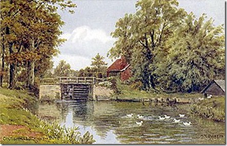
“When the flood came on August 26th 1912 all of the locks and some of the bridges (including the one pictured between Coltishall and Horstead) were washed out. The navigation was already in decline as the coming of the railways in the 1880's had dramatically cut the trade. After the flood the Navigation was never re-opened. Trading wherries caught upstream were abandoned with the exception of the Zulu which was man-hauled around the obstructions to gain her freedom.”
Now a new group wants to “raise the profile of our beautiful river” and it will use the 100th anniversary as a focus. There are already some great stories, documents and pictures on their website and the next meeting will take place in January. This painting is pinched from the website too.

No comments:
Post a Comment